• Featured
  • Catagories
  • Creative
  • Cine
  • Blog
Menu

leeburty.

adventures in the land of the long white cloud & beyond
  • Featured
  • Catagories
  • Creative
  • Cine
  • Blog
sam_5521.jpg

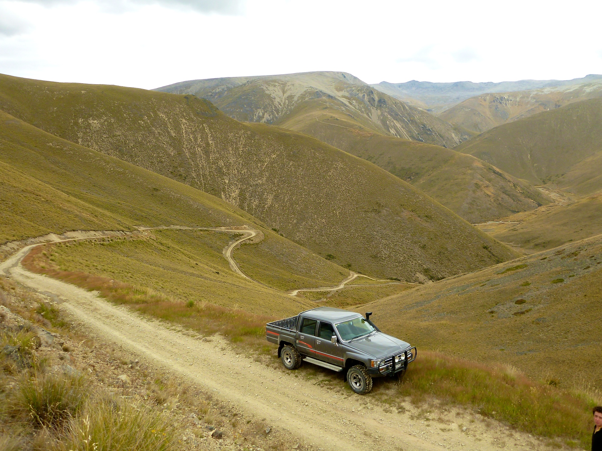
Birchwood Road 4WD & Canyon Creek Track - Ahuriri Conservation Park

March 16, 2013

Birchwood Road is a straight forward gravel track up the Ahuriri Valley, the first 21Km to the Park Boundary is easy 2WD access from this point a sign states the road as being 4WD. Although a little more rutted its still a straight forward track with a few ford and landslip crossings. 1 hour. 34km

From the road end I followed the walking track up over Canyon Creek through the beech forests and to the upper valley waterfalls, along the way I explored Canyon Creek for a possible future descent.  3-4h return. 16th March 2013

4WD & Walking RouteCanyon Creek TrackAhuriri Valley - Birchwood RoadAhuriri Valley RiverAhuriri WetlandsCanyon CreekCanyon CreekView from Canyon CreekView from top of CanyonBivvy SpotUpper ValleyUpper ValleyUpper Valley WaterfallsUpper Valley WaterfallsAhuriri Valley ReturnAhuriri Valley Return

In 4WD, Tramping
10 Comments
p1070141.jpg

West Manuherikia 4WD Track

March 2, 2013

The West and East Manuherikia tracks are within Oteake Conservation Area, both can be done as a loop track from either St Bathans or Omarama. We were traveling in one direction from St Bathans to Omarama so we only drove the West track.

St Bathans is well worth the stop the town has very nice charm and character, in its heyday it was a bustling community built upon the gold rush, the main attraction of the town is the Blue Lake, the 68m deep man made lake was formed from old sluicing works. Its now a wonderful swimming spot, one we couldn't resist.

After our swim we headed along the Hawkdun Runs Road to the start of our track. The West Manuherikia is a little bit more serious than the East as it has more river crossing and the roads up and down the saddle are narrow and exposed, but we still found the drive a breeze, albeit bumpy! The river crossing where simple but we can imagine they become alot more serious in high water. Along the way we stopped off at the two huts Boundary Creek Hut and Top Hut, both very nice huts but we favored the Top Hut that little bit more.

From the Top Hut we headed up the saddle to be confronted with spectacular views out towards Lake Ohau, Ahuriri River and Southern Alps from here the exposed track lead us down onto Broken Hut road for our return trip back to Wanaka over Lindis Pass.  West Manuherikia Track 28km. 2 hours. Crew: Lee & Sam. 2/3/13

West Manuherikia Track

West Manuherikia Track

Blue Lake

Blue Lake

Old Mining Equipment

Old Mining Equipment

p1070141.jpg

Nude Swim!

Sam Bomb

Sam Bomb

Town Pub

Town Pub

Fuel Stop

Fuel Stop

Window

Window

Hawkdun Runs Rd Hut

Hawkdun Runs Rd Hut

Info

Info

Boundary Creek Hut

Boundary Creek Hut

River Crossing

River Crossing

Top Hut

Top Hut

Top Hut

Top Hut

Saddle Road

Saddle Road

Views From Omarama Saddle

Views From Omarama Saddle

View From Omarama Saddle

View From Omarama Saddle

Valley Bottom towards Omarama

Valley Bottom towards Omarama

Sam after being stood on the back for the descent!

Sam after being stood on the back for the descent!

Camo Sheep

Camo Sheep

In 4WD
4 Comments
p1050787.jpg

Hawksburn Road 4WD Track

January 20, 2013
The Route. "i" = right turn

The Route. "i" = right turn

Sam tempted

Sam tempted

Sam fails

Sam fails

Sam

Sam

Suitable for Trucks!

Suitable for Trucks!

Sam

Sam

Clyde

Clyde

p1050787.jpg

Clyde Dam

Another outing for the truck and bike this time The Hawksburn Road, which begins at Bannockburn and skirts across the Cairnmuir Rages to finish up in Clyde. The drive has no real tests although there are plenty of side loops to have a play at. At one point on the road you need to take a right turn, otherwise you'll end up back in Bannockburn, basically follow the pylons! Theres also some very good downhill MTB single tracks dropping down into Clyde. 20km. 2 hours. Crew: Lee & Sam. 20th January 2013

In 4WD
1 Comment
sam_1450.jpg

Carricktown 4WD Track

December 15, 2012

This trip is a little bit more serious but luckily we've had some dry weather, i've been told it can easily wash out. The drive is defiantly alot of fun with some interesting sections, we took the truck and Sams bike. The track begins through a gate just at the top end of Quartzville road from here on in the drive climbs and climbs. Along the way are the remains of the old Carricktown and a bit further a short walk heads down towards the Young Austraillan Waterwheel. Eventually we crossed onto the Nevis Road for the return trip back towards Bannockburn. 14km. 1 hour (2 hour round trip). Crew: Lee, Emma & Sam. 15 Dec 2012

Our Route

Our Route

Old site

Old site

Sam's bike

Sam's bike

Climb

Climb

sam_1450.jpg

Fun terrain

Fun terrain

Fun terrain

View back toward Cromwell

View back toward Cromwell

Sam

Sam

Good vantage point

Good vantage point

Emma's turn on the bike

Emma's turn on the bike

Nearly the end of the trip, avoid next time!

Nearly the end of the trip, avoid next time!

Return down the Nevis Road

Return down the Nevis Road

Fin

Fin

In 4WD
2 Comments
sam_1359.jpg

Thomson Gorge Road 4WD Track

November 4, 2012

Our first true 4wd trip albeit fairly easy one, with lots of gates! The drive passes over the Dunstan mountains and past several old gold working sites, the 'Come In Time' Stamper battery is worth the stop and a torch would have been handy for the old mine shaft. 30km. 2 hour drive. Crew: Lee & Sam. 4 Nov 2012

Our Route "i" = Stamper Battery

Our Route "i" = Stamper Battery

Thomson Gorge Road

Thomson Gorge Road

Thomson Gorge Road

Thomson Gorge Road

Thomson Gorge Road

Thomson Gorge Road

SAM_1337

SAM_1337

SAM_1340

SAM_1340

SAM_1355

SAM_1355

sam_1359.jpg

Thomson Gorge Road

Thomson Gorge Road

Thomson Gorge Road

Thomson Gorge Road

Thomson Gorge Road

In 4WD
2 Comments

Latest Posts

Featured
Photography
Abstract Aerial Photography
Photography
Photography
Whitewater
Cascade Hut / Matukituki River
Whitewater
Whitewater
Whitewater
Lake Ellery & Burke Paddleboard
Whitewater
Whitewater
Family & Friends
Nikki + Lennon
Family & Friends
Family & Friends
Family & Friends
Cut throat nils
Family & Friends
Family & Friends
Family & Friends
Tony's 40th Birthday
Family & Friends
Family & Friends
Tramping
MatterHorn 10 year Anniversary
Tramping
Tramping
Tramping, Rock
The Sundial
Tramping, Rock
Tramping, Rock
Tramping
Hump Ridge Track
Tramping
Tramping
Tramping, Whitewater
Wairaurahiri River Packrafting
Tramping, Whitewater
Biking
Heaphy Track Bikepacking
Biking
Biking
Tramping, Whitewater
Hollyford and Pyke Packrafting Loop
Tramping, Whitewater
Tramping
Sharks Tooth Peak
Tramping
Tramping
Tramping
Cascade Saddle via Governors​ Ridge
Tramping
Tramping
Whitewater
East Matukituki Packrafting
Whitewater
Whitewater
Tramping
Rabbit Pass Mt Aspiring National Park
Tramping
Tramping
Biking
Crown Range to Cardrona MTB Pisa Range
Biking
Biking
Biking
Pisa Range Cross Country MTB
Biking
Biking
Biking, Boating, Tramping
Rob Roy Glacier - Mt Aspiring Hut
Biking, Boating, Tramping
Tramping
Motatapu Track - Fern Burn Hut
Tramping
Tramping
Snow, Tramping
Fog Peak - Mount Aspiring National Park & Weekend Fun
Snow, Tramping
Snow, Tramping
Tramping
Sentinel Peak - Hawea Conservation Park
Tramping
Tramping
Tramping
Waitaha River - Morgan Gorge Hidden Hot Pool
Tramping
Tramping
Tramping
Black Peak - Black Peak Conservation Area
Tramping
Tramping
Tramping
Aspiring Flats/Kitchener River - Mount Aspiring National Park
Tramping
Tramping
Whitewater
Matukituki River - Pack Raft Trip
Whitewater
Whitewater
Whitewater
Hawea Whitewater Park
Whitewater
Whitewater
Tramping
Corner Peak - Hawea Conservation Area
Tramping
Tramping
Whitewater
Pack Rafting Upper Matukituki
Whitewater
Whitewater
Tramping
Isthmus Peak - Matatiaho Conservation Area
Tramping
Tramping

Powered by Squarespace